
Gressoney-La-Trinité topographic map
Interactive map
Click on the map to display elevation.
About this map
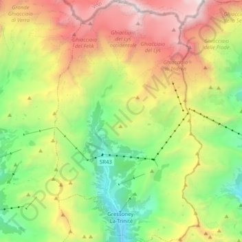
Name: Gressoney-La-Trinité topographic map, elevation, terrain.
Location: Gressoney-La-Trinité, Valle de Aosta, Italia (45.81870 7.78042 45.92701 7.87592)
Average elevation: 2,799 m
Minimum elevation: 1,609 m
Maximum elevation: 4,551 m