
Bartha topographic map
Interactive map
Click on the map to display elevation.
About this map
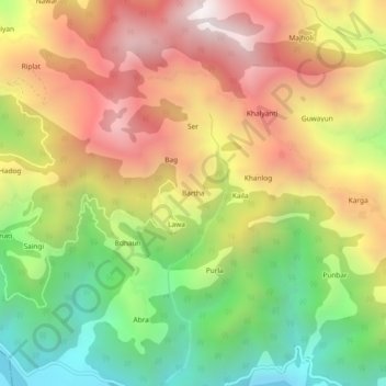
Name: Bartha topographic map, elevation, terrain.
Location: Bartha, Kamrau, Sirmaur, Himachal Pradesh, India (30.57271 77.54376 30.61271 77.58376)
Average elevation: 1,272 m
Minimum elevation: 556 m
Maximum elevation: 2,003 m
Other topographic maps
Click on a map to view its topography, its elevation and its terrain.
Ratmao
India > Himachal Pradesh > Kamrau > Kaffota
Ratmao, Kaffota, Kamrau, Sirmaur District, Himachal Pradesh, 173029, India
Average elevation: 1,478 m
Bhimgoda
India > Himachal Pradesh > Kamrau > Tilau
Bhimgoda, Tilau, Kamrau, Sirmaur, Himachal Pradesh, 173029, India
Average elevation: 1,530 m