
Amajuba topographic map
Interactive map
Click on the map to display elevation.
About this map
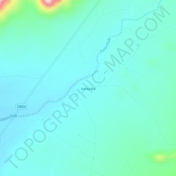
Name: Amajuba topographic map, elevation, terrain.
Location: Amajuba, Hardap, Namibia (-24.57377 16.01132 -24.53377 16.05132)
Average elevation: 1,006 m
Minimum elevation: 959 m
Maximum elevation: 1,295 m
Other topographic maps
Click on a map to view its topography, its elevation and its terrain.
Namib-Naukluft National Park
Namib-Naukluft National Park, Hardap, Namibia
Average elevation: 631 m
NamibRand Nature Reserve
NamibRand Nature Reserve, Hardap, Namibia
Average elevation: 1,160 m