Geolocate

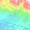
Absard topographic map

Click on the map to display elevation.

About this map

Name: Absard topographic map, elevation, terrain.

Location: Absard, Central District (Damavand County), Damavand County, Tehran Province, Iran (35.60872 52.14006 35.63080 52.16122)

Average elevation: 1,925 m

Minimum elevation: 1,846 m

Maximum elevation: 2,005 m

Other topographic maps

Click on a map to view its topography, its elevation and its terrain.

ولیران

Iran > Tehran Province > Damavand County > Damavand

Average elevation: 1,976 m

Gear up for your next adventure:

🥼Base Layers - Thermal base layers for temperature regulation
🧭Emergency Beacons - Safety beacons for remote outdoor locations
🛑Emergency Bivvy Bags - Heat-reflective survival bags for unexpected nights out
🧢Hiking Hats - Sun and weather protection for outdoor walks
🥾Hiking Boot Waterproofing Wax - Maintain the lifespan of your leather trekking boots

As an Amazon Associate, this site earns from qualifying purchases at no extra cost to you.