Geolocate

Greencastle topographic map

Click on the map to display elevation.

About this map
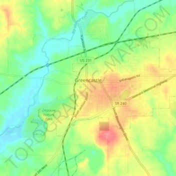
Name: Greencastle topographic map, elevation, terrain.

Location: Greencastle, Putnam County, Indiana, 46135, United States (39.62451 -86.87962 39.65862 -86.79803)

Average elevation: 236 m

Minimum elevation: 199 m

Maximum elevation: 292 m

Other topographic maps

Click on a map to view its topography, its elevation and its terrain.

Limedale

United States > Indiana > Putnam County

Average elevation: 233 m

Gear up for your next adventure:

🧭Professional Hiking Compasses - High-precision liquid-filled compasses for map reading and orientation
🔪Outdoor Multi-Tools - Versatile tools for gear repairs and food prep in the wild
📐Altimeters & Barometers - Tools for measuring altitude and air pressure
🧤Hiking Gloves - Warm and durable gloves for cold-weather walks
🧺Mesh Stuff Sacks - Breathable storage for wet gear or camp organization

As an Amazon Associate, this site earns from qualifying purchases at no extra cost to you.