
Jochstock topographic map
Interactive map
Click on the map to display elevation.
About this map
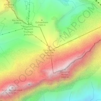
Name: Jochstock topographic map, elevation, terrain.
Location: Jochstock, Engelberg, Obwalden, Zwitserland (46.77142 8.39531 46.77152 8.39541)
Average elevation: 2,349 m
Minimum elevation: 1,738 m
Maximum elevation: 3,027 m