
De Horst topographic map
Interactive map
Click on the map to display elevation.
About this map
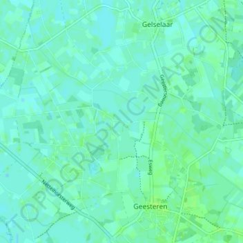
Name: De Horst topographic map, elevation, terrain.
Location: De Horst, Geldern, Niederlande, 7274, Niederlande (52.13319 6.49792 52.17319 6.53792)
Average elevation: 15 m
Minimum elevation: 12 m
Maximum elevation: 20 m