
Bisgletscher topographic map
Interactive map
Click on the map to display elevation.
About this map
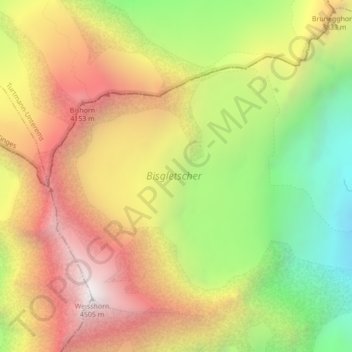
Name: Bisgletscher topographic map, elevation, terrain.
Location: Bisgletscher, Felsgrat, Randa, Visp, Wallis, 3928, Schweiz (46.10172 7.71417 46.12156 7.75741)
Average elevation: 3,589 m
Minimum elevation: 2,666 m
Maximum elevation: 4,463 m
Other topographic maps
Click on a map to view its topography, its elevation and its terrain.
Mischabeljoch
Mischabeljoch, Normalweg zum Dom, Randa, Visp, Wallis, 3928, Schweiz
Average elevation: 3,662 m
Hohlichtgletscher
Hohlichtgletscher, Schaligletscher 2011, Randa, Visp, Wallis, 3928, Schweiz
Average elevation: 3,194 m