
Si Abdelghani topographic map
Interactive map
Click on the map to display elevation.
About this map
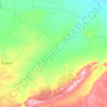
Name: Si Abdelghani topographic map, elevation, terrain.
Location: Si Abdelghani, Sougueur District, Tiaret, Algeria (35.09626 1.51381 35.32131 1.82957)
Average elevation: 1,092 m
Minimum elevation: 905 m
Maximum elevation: 1,495 m