
Thank you for supporting this site ❤️
Make a donation
Make a donation
Gear up for your next adventure:
As an Amazon Associate, this site earns from qualifying purchases at no extra cost to you.
Gulgam topographic map
Click on the map to display elevation.
Thank you for supporting this site ❤️
Make a donation
Make a donation
Gear up for your next adventure:
As an Amazon Associate, this site earns from qualifying purchases at no extra cost to you.
About this map
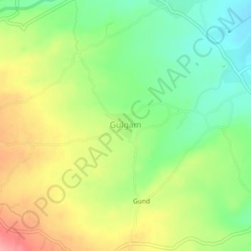
Name: Gulgam topographic map, elevation, terrain.
Location: Gulgam, Handwara, Kupwara District, Jammu and Kashmir, India (34.46996 74.13547 34.47255 74.13950)
Average elevation: 1,803 m
Minimum elevation: 1,756 m
Maximum elevation: 1,862 m
Thank you for supporting this site ❤️
Make a donation
Make a donation
Gear up for your next adventure:
As an Amazon Associate, this site earns from qualifying purchases at no extra cost to you.