Geolocate

Elrick topographic map

Click on the map to display elevation.

About this map

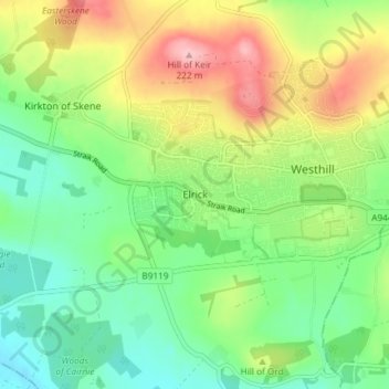
Name: Elrick topographic map, elevation, terrain.

Location: Elrick, Aberdeenshire, Scotland, AB32 6HX, United Kingdom (57.13105 -2.32219 57.17105 -2.28219)

Average elevation: 126 m

Minimum elevation: 68 m

Maximum elevation: 221 m

Aberdeenshire trails, hiking, mountain biking, running and outdoor activities

Gear up for your next adventure:

🎒Hiking Daypacks - Compact backpacks ideal for short hikes and excursions
🛰️Satellite Messengers - Emergency communication devices for areas without mobile signal
🧣Fleece Neck Warmers - Extra insulation for winter topographic surveys
🎒Hiking Daypacks (20L) - Compact backpacks for day trips and technical mountain ascents
🧺Mesh Stuff Sacks - Breathable storage for wet gear or camp organization

As an Amazon Associate, this site earns from qualifying purchases at no extra cost to you.