
Thank you for supporting this site ❤️
Make a donation
Make a donation
Gear up for your next adventure:
As an Amazon Associate, this site earns from qualifying purchases at no extra cost to you.
Montouto topographic map
Click on the map to display elevation.
Thank you for supporting this site ❤️
Make a donation
Make a donation
Gear up for your next adventure:
As an Amazon Associate, this site earns from qualifying purchases at no extra cost to you.
About this map
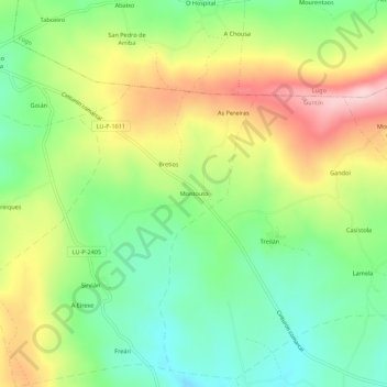
Name: Montouto topographic map, elevation, terrain.
Location: Montouto, Sirvián, Guntín, Lugo, Galicia, 27232, España (42.92187 -7.72878 42.96187 -7.68878)
Average elevation: 604 m
Minimum elevation: 506 m
Maximum elevation: 743 m
Thank you for supporting this site ❤️
Make a donation
Make a donation
Gear up for your next adventure:
As an Amazon Associate, this site earns from qualifying purchases at no extra cost to you.