
Kharsia Tahsil topographic map
Interactive map
Click on the map to display elevation.
About this map
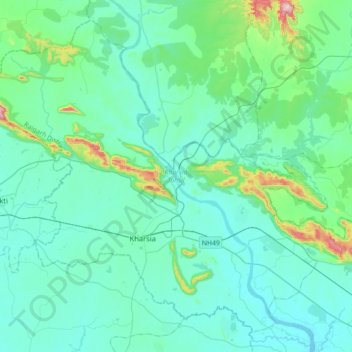
Name: Kharsia Tahsil topographic map, elevation, terrain.
Location: Kharsia Tahsil, Raigarh, Chhattisgarh, India (21.90499 82.92874 22.19735 83.29360)
Average elevation: 271 m
Minimum elevation: 208 m
Maximum elevation: 665 m
Other topographic maps
Click on a map to view its topography, its elevation and its terrain.
Kharsia
India > Chhattisgarh > Kharsia Tahsil > Kharsia
Kharsia, Kharsia Tahsil, Raigarh, Chhattisgarh, 496661, India
Average elevation: 253 m