
Wyoming topographic map
Interactive map
Click on the map to display elevation.
About this map
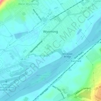
Name: Wyoming topographic map, elevation, terrain.
Location: Wyoming, Luzerne County, Pennsylvania, United States (41.29455 -75.86141 41.31773 -75.82214)
Average elevation: 174 m
Minimum elevation: 159 m
Maximum elevation: 270 m
The flood of 2011 prompted the evacuation of the Wilkes-Barre Wyoming Valley Airport (in southern Wyoming). The planes were moved to a higher elevation to prevent flood damage; they were relocated to the Wyoming Monument.