
Reiriz topographic map
Interactive map
Click on the map to display elevation.
About this map
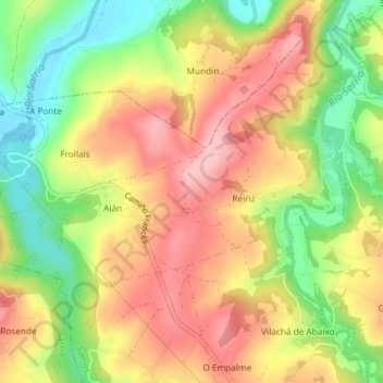
Name: Reiriz topographic map, elevation, terrain.
Location: Reiriz, Samos, Sarria, Lugo, Galicia, España (42.74118 -7.38844 42.75804 -7.35380)
Average elevation: 535 m
Minimum elevation: 447 m
Maximum elevation: 612 m
Other topographic maps
Click on a map to view its topography, its elevation and its terrain.