
Thank you for supporting this site ❤️
Make a donation
Make a donation
Gear up for your next adventure:
As an Amazon Associate, this site earns from qualifying purchases at no extra cost to you.
Montseny topographic map
Click on the map to display elevation.
Thank you for supporting this site ❤️
Make a donation
Make a donation
Gear up for your next adventure:
As an Amazon Associate, this site earns from qualifying purchases at no extra cost to you.
About this map
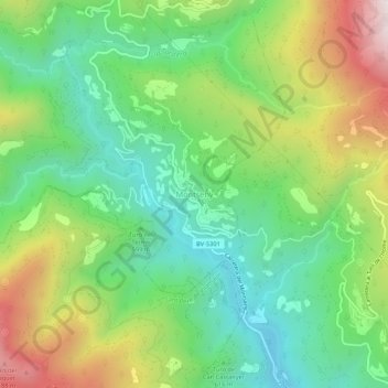
Name: Montseny topographic map, elevation, terrain.
Location: Montseny, Vallès Oriental, Barcelona, Catalonia, 08469, Spain (41.73937 2.37521 41.77937 2.41521)
Average elevation: 679 m
Minimum elevation: 325 m
Maximum elevation: 1,297 m
Thank you for supporting this site ❤️
Make a donation
Make a donation
Gear up for your next adventure:
As an Amazon Associate, this site earns from qualifying purchases at no extra cost to you.