Geolocate

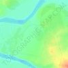
Al Anbar topographic map

Click on the map to display elevation.

About this map

Name: Al Anbar topographic map, elevation, terrain.

Location: Al Anbar, Al-Saqlawiyah Subdistrict, Al-Falujah District, Al-Anbar Governorate, Iraq (33.35580 43.70589 33.37580 43.72589)

Average elevation: 46 m

Minimum elevation: 43 m

Maximum elevation: 53 m

Other topographic maps

Click on a map to view its topography, its elevation and its terrain.
Al-Rutba District

Iraq > Al-Anbar Governorate

Average elevation: 468 m

Al Ubaydi

Iraq > Al-Anbar Governorate

Average elevation: 172 m

Gear up for your next adventure:

🍲Portable Camping Stoves - Fast-boiling stoves for hot meals on remote topographic survey trips
🛌Sleeping Mats - Insulated mats for comfortable outdoor sleeping
📦Dry Bags - Waterproof bags to protect gear from rain
🥤Hiking Water Bottles - Reusable bottles for hydration on the trail
🧭Orienteering Compasses - Accurate compasses for map-based navigation

As an Amazon Associate, this site earns from qualifying purchases at no extra cost to you.