
Kenadsa topographic map
Interactive map
Click on the map to display elevation.
About this map
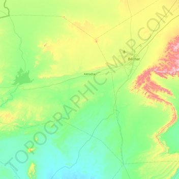
Name: Kenadsa topographic map, elevation, terrain.
Location: Kenadsa, Kénadsa District, Bashar, 08011, Algeria (31.18327 -3.13225 31.79656 -2.26963)
Average elevation: 747 m
Minimum elevation: 569 m
Maximum elevation: 1,319 m