
Младеновац (село) topographic map
Interactive map
Click on the map to display elevation.
About this map
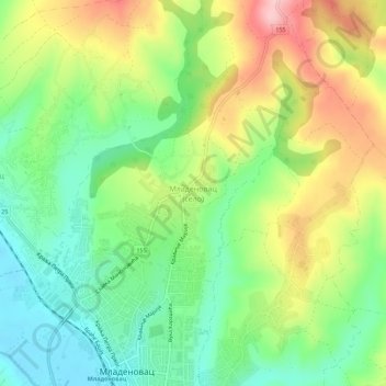
Name: Младеновац (село) topographic map, elevation, terrain.
Average elevation: 206 m
Minimum elevation: 131 m
Maximum elevation: 317 m
Other topographic maps
Click on a map to view its topography, its elevation and its terrain.
Jagnjilo
Serbia > Central Serbia > City of Belgrade > Mladenovac Urban Municipality > Jagnjilo
Jagnjilo, Mladenovac Urban Municipality, City of Belgrade, Central Serbia, Serbia
Average elevation: 155 m