
Weißer Stein topographic map
Interactive map
Click on the map to display elevation.
About this map
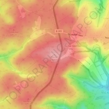
Name: Weißer Stein topographic map, elevation, terrain.
Location: Weißer Stein, Bullange, Verviers, Liège, Wallonie, Belgique (50.40791 6.36708 50.40801 6.36718)
Average elevation: 657 m
Minimum elevation: 575 m
Maximum elevation: 697 m
Other topographic maps
Click on a map to view its topography, its elevation and its terrain.