
Thank you for supporting this site ❤️
Make a donation
Make a donation
Gear up for your next adventure:
As an Amazon Associate, this site earns from qualifying purchases at no extra cost to you.
Rongbuk topographic map
Click on the map to display elevation.
Thank you for supporting this site ❤️
Make a donation
Make a donation
Gear up for your next adventure:
As an Amazon Associate, this site earns from qualifying purchases at no extra cost to you.
About this map
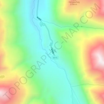
Name: Rongbuk topographic map, elevation, terrain.
Location: Rongbuk, 扎西宗乡, Tingri County, Shigatse, Tibet, China (28.17464 86.80692 28.21464 86.84692)
Average elevation: 5,311 m
Minimum elevation: 4,873 m
Maximum elevation: 6,023 m
Thank you for supporting this site ❤️
Make a donation
Make a donation
Gear up for your next adventure:
As an Amazon Associate, this site earns from qualifying purchases at no extra cost to you.