
Rothwell topographic map
Click on the map to display elevation.
About this map
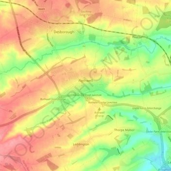
Name: Rothwell topographic map, elevation, terrain.
Location: Rothwell, North Northamptonshire, England, United Kingdom (52.40352 -0.84283 52.43758 -0.73461)
Average elevation: 117 m
Minimum elevation: 66 m
Maximum elevation: 159 m
North Northamptonshire trails, hiking, mountain biking, running and outdoor activities
Other topographic maps
Click on a map to view its topography, its elevation and its terrain.
Irchester Country Park
United Kingdom > England > North Northamptonshire > Little Irchester
Average elevation: 60 m
River Nene Navigation
United Kingdom > England > North Northamptonshire > Irchester
Average elevation: 55 m