
الزهور topographic map
Interactive map
Click on the map to display elevation.
About this map
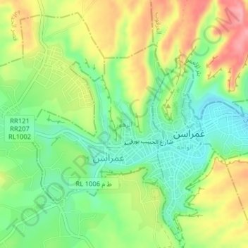
Name: الزهور topographic map, elevation, terrain.
Location: الزهور, معتمدية غمراسن, Tataouine, 3220, Tunisia (33.05218 10.31711 33.06962 10.33596)
Average elevation: 312 m
Minimum elevation: 260 m
Maximum elevation: 380 m