Geolocate

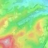
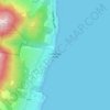
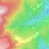
Austins Ferry topographic map

Click on the map to display elevation.

About this map

Name: Austins Ferry topographic map, elevation, terrain.

Location: Austins Ferry, Hobart, City of Glenorchy, Tasmania, Australia (-42.78450 147.23846 -42.76512 147.25799)

Average elevation: 32 m

Minimum elevation: -6 m

Maximum elevation: 148 m

Other topographic maps

Click on a map to view its topography, its elevation and its terrain.
Selfs Point

Australia > Tasmania > Hobart

Average elevation: 17 m

Waterworks Reserve

Australia > Tasmania > Hobart

Average elevation: 240 m

James Austin Park

Australia > Tasmania > Hobart

Average elevation: 25 m

Glenrose Park

Australia > Tasmania > Hobart

Average elevation: 181 m

Flagstaff Hill

Australia > Tasmania > Hobart

Average elevation: 204 m

Perrins Ridge

Australia > Tasmania > Hobart

Average elevation: 467 m

Cartwright Point

Australia > Tasmania > Hobart

Average elevation: 59 m

Mount Direction

Australia > Tasmania > Hobart

Average elevation: 166 m

Glebe Hill

Australia > Tasmania > Hobart

Average elevation: 66 m

Knocklofty

Australia > Tasmania > Hobart

Average elevation: 185 m

Snug Falls

Australia > Tasmania > Hobart > Snug

Average elevation: 336 m

Tolosa Park

Australia > Tasmania > Hobart

Average elevation: 182 m

Single Hill Bush Reserve

Australia > Tasmania > Hobart

Average elevation: 34 m

Hinsby Beach

Australia > Tasmania > Hobart

Average elevation: 86 m

Gear up for your next adventure:

🥾Walking Shoes - Lightweight walking shoes for countryside and coastal paths
🧢Thermal Beanie Hats - Prevent heat loss from the head in windy summit conditions
🍳Camping Stoves - Compact stoves for outdoor cooking
⛺Camping Shelters - Emergency and lightweight shelters for outdoor use
👕Merino Base Layers - Natural temperature regulation for cold weather hiking and camping

As an Amazon Associate, this site earns from qualifying purchases at no extra cost to you.