
Thank you for supporting this site ❤️
Make a donation
Make a donation
Gear up for your next adventure:
As an Amazon Associate, this site earns from qualifying purchases at no extra cost to you.
Okotoks topographic map
Click on the map to display elevation.
Thank you for supporting this site ❤️
Make a donation
Make a donation
Gear up for your next adventure:
As an Amazon Associate, this site earns from qualifying purchases at no extra cost to you.
About this map
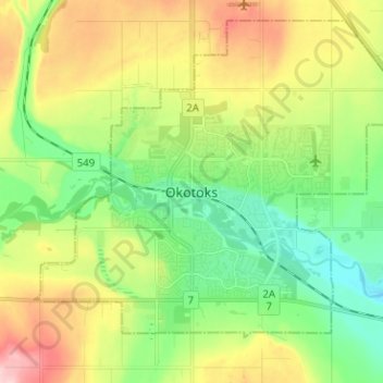
Name: Okotoks topographic map, elevation, terrain.
Location: Okotoks, Town of Okotoks, Alberta, T1S 2N7, Canada (50.68537 -114.01508 50.76537 -113.93508)
Average elevation: 1,096 m
Minimum elevation: 1,026 m
Maximum elevation: 1,209 m
Thank you for supporting this site ❤️
Make a donation
Make a donation
Gear up for your next adventure:
As an Amazon Associate, this site earns from qualifying purchases at no extra cost to you.