
Thank you for supporting this site ❤️
Make a donation
Make a donation
Gear up for your next adventure:
As an Amazon Associate, this site earns from qualifying purchases at no extra cost to you.
Treska topographic map
Click on the map to display elevation.
Thank you for supporting this site ❤️
Make a donation
Make a donation
Gear up for your next adventure:
As an Amazon Associate, this site earns from qualifying purchases at no extra cost to you.
About this map
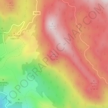
Name: Treska topographic map, elevation, terrain.
Location: Treska, Općina Čavle, Primorje-Gorski Kotar County, Croatia (45.40599 14.57093 45.40609 14.57103)
Average elevation: 1,067 m
Minimum elevation: 701 m
Maximum elevation: 1,309 m
Thank you for supporting this site ❤️
Make a donation
Make a donation
Gear up for your next adventure:
As an Amazon Associate, this site earns from qualifying purchases at no extra cost to you.