Geolocate

Payao topographic map

Click on the map to display elevation.

About this map
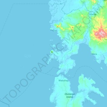
Name: Payao topographic map, elevation, terrain.

Location: Payao, Zamboanga Sibugay, Zamboanga Peninsula, 7008, Philippines (7.33514 122.55866 7.68175 122.92453)

Average elevation: 20 m

Minimum elevation: -4 m

Maximum elevation: 573 m

Other topographic maps

Click on a map to view its topography, its elevation and its terrain.

San Isidro

Philippines > Zamboanga Sibugay > Payao

Average elevation: 109 m

Kulisap

Philippines > Zamboanga Sibugay > Payao

Average elevation: 57 m

Gear up for your next adventure:

⌚Altimeter Watches - Watches measuring altitude for mountain activities
🧥Packable Down Jackets - Lightweight warmth that compresses small in your bag
🎿Telescopic Trekking Poles - Reduces knee strain on steep topographic descents
📐Altimeters & Barometers - Tools for measuring altitude and air pressure
📚UK Hiking Guidebooks - Detailed route descriptions for the Lake District, Peaks, and Highlands

As an Amazon Associate, this site earns from qualifying purchases at no extra cost to you.