Geolocate

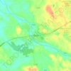
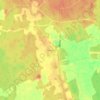
Rusko topographic map

Click on the map to display elevation.

About this map

Name: Rusko topographic map, elevation, terrain.

Location: Rusko, Turku sub-region, Southwest Finland, Mainland Finland, Finland (60.50380 22.14383 60.73730 22.41500)

Average elevation: 43 m

Minimum elevation: -3 m

Maximum elevation: 95 m

Other topographic maps

Click on a map to view its topography, its elevation and its terrain.

Ruskiskari

Finland > Southwest Finland > Kustavi

Average elevation: 1 m

Karjakoski

Finland > Southwest Finland > Mynämäki > Kivikylä

Average elevation: 27 m

Tiikarla

Finland > Southwest Finland > Karuna

Average elevation: 24 m

Puolalanpuisto

Finland > Southwest Finland > Turku

Average elevation: 17 m

Kalanti

Finland > Southwest Finland > Uusikaupunki

Average elevation: 16 m

Alastaro

Finland > Southwest Finland

Average elevation: 80 m

Kaivonpyöli

Finland > Southwest Finland > Salo > Muurla

Average elevation: 45 m

Ojankulma

Finland > Southwest Finland > Nousiainen

Average elevation: 44 m

Palstakulma

Finland > Southwest Finland > Salo > Halikko

Average elevation: 21 m

31.8

Finland > Southwest Finland > Kaarina

Average elevation: 11 m

Pyhe

Finland > Southwest Finland > Mynämäki

Average elevation: 8 m

Riihikoski

Finland > Southwest Finland

Average elevation: 68 m

Virttaa

Finland > Southwest Finland > Loimaa

Average elevation: 86 m

Kallela

Finland > Southwest Finland > Lemu

Average elevation: 17 m

Gear up for your next adventure:

🧼Biodegradable Soap - Leave-no-trace hygiene for multi-day mountain treks
🔋Rechargeable Batteries - Eco-friendly power for headlamps and older GPS units
🔪Outdoor Multi-Tools - Versatile tools for gear repairs and food prep in the wild
🧼Technical Clothing Wash - Special soap to clean and restore waterproof membranes
🎒Backpack Rain Covers - Universal waterproof covers to protect your gear from downpours

As an Amazon Associate, this site earns from qualifying purchases at no extra cost to you.