
Qingxin District topographic map
Interactive map
Click on the map to display elevation.
About this map
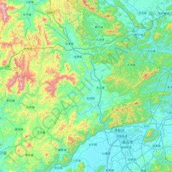
Name: Qingxin District topographic map, elevation, terrain.
Location: Qingxin District, Qingyuan City, Guangdong Province, China (23.54780 112.56313 24.31856 113.10660)
Average elevation: 258 m
Minimum elevation: 3 m
Maximum elevation: 1,397 m
Other topographic maps
Click on a map to view its topography, its elevation and its terrain.