
La Vernia topographic map
Interactive map
Click on the map to display elevation.
About this map
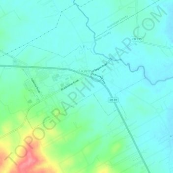
Name: La Vernia topographic map, elevation, terrain.
Location: La Vernia, Wilson County, Texas, Estados Unidos da América (29.34044 -98.15144 29.36362 -98.09683)
Average elevation: 158 m
Minimum elevation: 138 m
Maximum elevation: 228 m