Geolocate

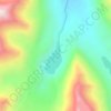
Lachat topographic map

Click on the map to display elevation.

About this map

Name: Lachat topographic map, elevation, terrain.

Location: Lachat, Mashabrum Tehsil, Ghanche District, Baltistan Division, Gilgit-Baltistan, Pakistan (35.24326 76.61918 35.28326 76.65918)

Average elevation: 3,418 m

Minimum elevation: 2,787 m

Maximum elevation: 4,882 m

Other topographic maps

Click on a map to view its topography, its elevation and its terrain.
Barah Broq

Pakistan > Gilgit-Baltistan > Ghanche District

Average elevation: 4,718 m

Gear up for your next adventure:

🧼Biodegradable Soap - Leave-no-trace hygiene for multi-day mountain treks
🧥Softshell Jackets - Breathable jackets for active outdoor use
⌚GPS Outdoor Watches - Watches with GPS tracking for hiking and exploration
🧦Hiking Socks - Breathable socks designed to prevent blisters on long walks
🔋Solar Chargers - Eco-friendly charging solutions for outdoor use

As an Amazon Associate, this site earns from qualifying purchases at no extra cost to you.