
Thank you for supporting this site ❤️
Make a donation
Make a donation
Gear up for your next adventure:
As an Amazon Associate, this site earns from qualifying purchases at no extra cost to you.
Kharpur topographic map
Click on the map to display elevation.
Thank you for supporting this site ❤️
Make a donation
Make a donation
Gear up for your next adventure:
As an Amazon Associate, this site earns from qualifying purchases at no extra cost to you.
About this map
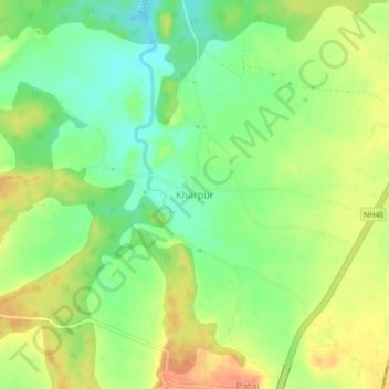
Name: Kharpur topographic map, elevation, terrain.
Location: Kharpur, Guna Tahsil, Guna, Madhya Pradesh, India (24.74435 77.33964 24.78435 77.37964)
Average elevation: 491 m
Minimum elevation: 469 m
Maximum elevation: 513 m
Thank you for supporting this site ❤️
Make a donation
Make a donation
Gear up for your next adventure:
As an Amazon Associate, this site earns from qualifying purchases at no extra cost to you.