
Rapides des Cèdres topographic map
Interactive map
Click on the map to display elevation.
About this map
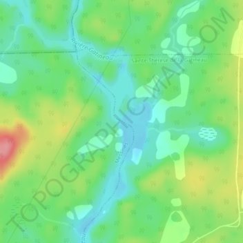
Name: Rapides des Cèdres topographic map, elevation, terrain.
Average elevation: 178 m
Minimum elevation: 145 m
Maximum elevation: 240 m
Other topographic maps
Click on a map to view its topography, its elevation and its terrain.
Grand lac des Cèdres
Canada > Québec > La Vallée-de-la-Gatineau > Messines
Grand lac des Cèdres, Messines, La Vallée-de-la-Gatineau, Outaouais, Québec, Canada
Average elevation: 218 m