Geolocate

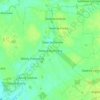
Brok topographic map

Click on the map to display elevation.

About this map

Name: Brok topographic map, elevation, terrain.

Location: Brok, gmina Brok, Ostrów Mazowiecka County, Masovian Voivodeship, Poland (52.67506 21.79236 52.72197 21.96827)

Average elevation: 105 m

Minimum elevation: 91 m

Maximum elevation: 128 m

Other topographic maps

Click on a map to view its topography, its elevation and its terrain.

Gear up for your next adventure:

🎒Backpack Rain Covers - Universal waterproof covers to protect your gear from downpours
🧤Hiking Gloves - Warm and durable gloves for cold-weather walks
👖Packable Overtrousers - Quick-deploy rain protection for legs in sudden storms
🚲Cycling GPS Computers - Track elevation and topographic routes on two wheels
🧴Sport Sunscreen Sticks - High-protection sunblock that won't run into your eyes on the trail

As an Amazon Associate, this site earns from qualifying purchases at no extra cost to you.