Geolocate

Halapar topographic map

Click on the map to display elevation.

About this map

Name: Halapar topographic map, elevation, terrain.

Location: Halapar, Mandvi Taluka, Kachchh, Gujarat, 370405, India (23.00184 69.09340 23.04184 69.13340)

Average elevation: 39 m

Minimum elevation: 25 m

Maximum elevation: 53 m

Other topographic maps

Click on a map to view its topography, its elevation and its terrain.
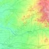
Mandvi Taluka

India > Gujarat > Mandvi Taluka

Average elevation: 73 m

Gear up for your next adventure:

🔭Compact Hiking Binoculars - Lightweight optics for scouting terrain and spotting wildlife
🧢Waterproof Hiking Hats - Keep the rain off your face while studying topographic maps
🔋Power Banks - Portable chargers for long outdoor trips
🪓Outdoor Multitools - Versatile tools for hiking and camping
👟Heavy Duty Boot Laces - Always carry a spare for your hiking footwear

As an Amazon Associate, this site earns from qualifying purchases at no extra cost to you.