Geolocate

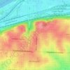
Jeffreys topographic map

Click on the map to display elevation.

About this map

Name: Jeffreys topographic map, elevation, terrain.

Location: Jeffreys, Kansas City, Jackson County, Missouri, 64137, United States (38.90806 -94.55134 38.94806 -94.51134)

Average elevation: 296 m

Minimum elevation: 255 m

Maximum elevation: 323 m

Other topographic maps

Click on a map to view its topography, its elevation and its terrain.
Gear up for your next adventure:

📱Phone Mounts for Hiking - Secure mounts to carry your phone on trails
📦Dry Bags - Waterproof bags to protect gear from rain
🎿Telescopic Trekking Poles - Reduces knee strain on steep topographic descents
🥼Base Layers - Thermal base layers for temperature regulation
👖Convertible Hiking Trousers - Versatile zip-off pants for changing mountain weather conditions

As an Amazon Associate, this site earns from qualifying purchases at no extra cost to you.