Geolocate

Saguing topographic map

Click on the map to display elevation.

About this map
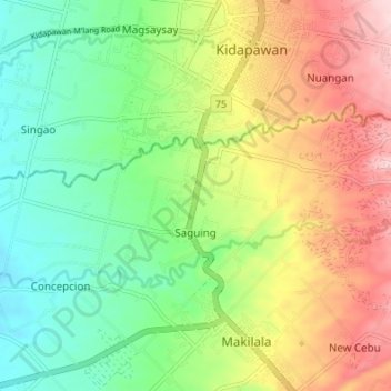
Name: Saguing topographic map, elevation, terrain.

Location: Saguing, Makilala, Cotabato, Soccsksargen, 9401, Philippines (6.96848 125.04744 6.99994 125.11525)

Average elevation: 237 m

Minimum elevation: 137 m

Maximum elevation: 380 m

Gear up for your next adventure:

⛺Lightweight Solo Tents - Backpacking tents designed for wild camping in the UK highlands
🛰️Outdoor GPS Navigation - Navigation devices for remote and off-grid areas
🥾Hiking Boot Waterproofing Wax - Maintain the lifespan of your leather trekking boots
🔪Outdoor Multi-Tools - Versatile tools for gear repairs and food prep in the wild
💧Hydration Reservoirs - Convenient water bladders for hands-free drinking on the move

As an Amazon Associate, this site earns from qualifying purchases at no extra cost to you.