
Le Val Bernard topographic map
Interactive map
Click on the map to display elevation.
About this map
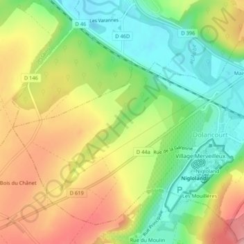
Name: Le Val Bernard topographic map, elevation, terrain.
Average elevation: 197 m
Minimum elevation: 143 m
Maximum elevation: 258 m
Other topographic maps
Click on a map to view its topography, its elevation and its terrain.
Le Pré Bouché
Frankrijk > Grand Est > Aube > Dolancourt
Le Pré Bouché, Village Canadien, Galon, Dolancourt, Bar-sur-Aube, Aube, Grand Est, Metropolitaans Frankrijk, 10200, Frankrijk
Average elevation: 189 m