Geolocate

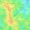
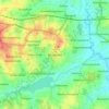
560036 topographic map

Click on the map to display elevation.

About this map

Name: 560036 topographic map, elevation, terrain.

Location: 560036, K.R Pura, Bengaluru East City Corporation, Bengaluru, Bangalore East, Bengaluru Urban, Karnataka, India (12.99435 77.67681 13.03809 77.71917)

Average elevation: 889 m

Minimum elevation: 864 m

Maximum elevation: 916 m

Other topographic maps

Click on a map to view its topography, its elevation and its terrain.
Whitefield

India > Karnataka > Bangalore East > Bengaluru

Average elevation: 875 m

Carmelaram

India > Karnataka > Bangalore East > Bengaluru

Average elevation: 890 m

Balagere

India > Karnataka > Bangalore East > Bengaluru > Balagere

Average elevation: 874 m

Varthur Lake

India > Karnataka > Bangalore East > Bengaluru

Average elevation: 869 m

Bileshivale

India > Karnataka > Bangalore East > Bengaluru

Average elevation: 887 m

Hoodi Lake

India > Karnataka > Bangalore East > Bengaluru > Sadaramangala

Average elevation: 889 m

Kodigehalli

India > Karnataka > Bangalore East > Bengaluru

Average elevation: 881 m

Gear up for your next adventure:

🛰️Satellite Messengers - Emergency communication devices for areas without mobile signal
🧺Mesh Stuff Sacks - Breathable storage for wet gear or camp organization
👟Men's Trail Running Shoes - Lightweight grip for fast movement over topographic contours
🥄Titanium Camping Sporks - The ultimate lightweight utensil for trail meals
🔋Solar Power Banks - Keep your GPS and phone charged during multi-day expeditions

As an Amazon Associate, this site earns from qualifying purchases at no extra cost to you.