
Rossão topographic map
Interactive map
Click on the map to display elevation.
About this map
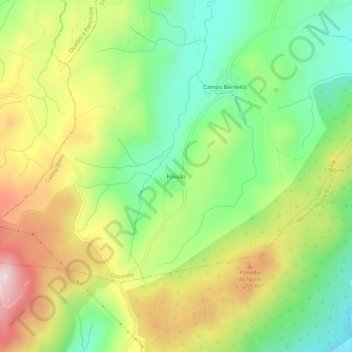
Name: Rossão topographic map, elevation, terrain.
Location: Rossão, Gosende, Castro Daire, Viseu, Portugal (40.96656 -7.95479 41.00656 -7.91479)
Average elevation: 1,096 m
Minimum elevation: 929 m
Maximum elevation: 1,320 m
Other topographic maps
Click on a map to view its topography, its elevation and its terrain.
Peixeninho
Portugal > Viseu > Castro Daire > Gosende
Peixeninho, Gosende, Castro Daire, Viseu, Portugal
Average elevation: 969 m
Cotelo
Portugal > Viseu > Castro Daire > Gosende
Cotelo, Gosende, Castro Daire, Viseu, Portugal
Average elevation: 1,059 m