
Brotorp topographic map
Interactive map
Click on the map to display elevation.
About this map
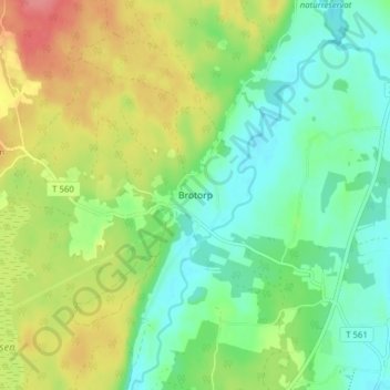
Name: Brotorp topographic map, elevation, terrain.
Location: Brotorp, Lekebergs kommun, Örebro County, 716 31, Sweden (59.18944 14.83360 59.22944 14.87360)
Average elevation: 75 m
Minimum elevation: 46 m
Maximum elevation: 122 m
Other topographic maps
Click on a map to view its topography, its elevation and its terrain.