
Le Gai Lieu topographic map
Interactive map
Click on the map to display elevation.
About this map
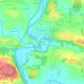
Name: Le Gai Lieu topographic map, elevation, terrain.
Average elevation: 41 m
Minimum elevation: 8 m
Maximum elevation: 112 m
Other topographic maps
Click on a map to view its topography, its elevation and its terrain.
La Basse Bouëxière
France > Brittany > Ille-et-Vilaine > Guichen
La Basse Bouëxière, Guichen, Redon, Ille-et-Vilaine, Brittany, Metropolitan France, 35580, France
Average elevation: 48 m