Geolocate

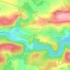
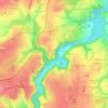
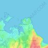
Hillion topographic map

Click on the map to display elevation.

About this map

Name: Hillion topographic map, elevation, terrain.

Location: Hillion, Saint-Brieuc, Côtes-d'Armor, Brittany, Metropolitan France, 22120, France (48.47226 -2.68470 48.53606 -2.60589)

Average elevation: 34 m

Minimum elevation: -1 m

Maximum elevation: 104 m

Other topographic maps

Click on a map to view its topography, its elevation and its terrain.
Ploumanac'h

France > Brittany > Côtes-d'Armor

Average elevation: 10 m

Lannion

France > Brittany > Côtes-d'Armor > Lannion > Lannion

Average elevation: 72 m

Penker

France > Brittany > Côtes-d'Armor > Louannec

Average elevation: 44 m

La Croix de Bois

France > Brittany > Côtes-d'Armor > Boqueho

Average elevation: 190 m

La Buglais

France > Brittany > Côtes-d'Armor > Lancieux

Average elevation: 8 m

La Menardais

France > Brittany > Côtes-d'Armor > Taden

Average elevation: 55 m

Pont Auffret

France > Brittany > Côtes-d'Armor > Rostrenen

Average elevation: 196 m

Rumoyec

France > Brittany > Côtes-d'Armor > Plusquellec

Average elevation: 162 m

Gear up for your next adventure:

🗺️Scratch-off Peak Maps - Track your progress climbing Munros or Wainwrights
🦟Anti-Midge & Tick Repellent - Vital for hiking in the Scottish Highlands during summer
📷Camera Straps - Secure straps for carrying cameras while walking
🎒Backpack Rain Covers - Universal waterproof covers to protect your gear from downpours
📱Rugged Phone Cases - Heavy-duty protection for smartphones used as secondary GPS tools

As an Amazon Associate, this site earns from qualifying purchases at no extra cost to you.