Geolocate

Assi Youcef topographic map

Click on the map to display elevation.

About this map
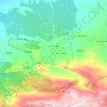
Name: Assi Youcef topographic map, elevation, terrain.

Location: Assi Youcef, Boghni District, Tizi Ouzou, 15000, Algeria (36.45929 3.98759 36.54101 4.06701)

Average elevation: 934 m

Minimum elevation: 295 m

Maximum elevation: 2,143 m

Gear up for your next adventure:

🍳Camping Stoves - Compact stoves for outdoor cooking
🛌Sleeping Mats - Insulated mats for comfortable outdoor sleeping
⌚Altimeter Watches - Watches measuring altitude for mountain activities
📦Dry Bags - Waterproof bags to protect gear from rain
🌄Compact Monoculars - Lightweight optics for hiking

As an Amazon Associate, this site earns from qualifying purchases at no extra cost to you.