Geolocate

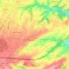
Ville topographic map

Click on the map to display elevation.

About this map

Name: Ville topographic map, elevation, terrain.

Location: Ville, My, Ferrières, Huy, Liège, Wallonia, 4190, Belgium (50.39661 5.56782 50.43661 5.60782)

Average elevation: 260 m

Minimum elevation: 152 m

Maximum elevation: 354 m

Other topographic maps

Click on a map to view its topography, its elevation and its terrain.
Fize-Fontaine

Belgium > Liège > Huy > Villers-le-Bouillet

Average elevation: 185 m

Huy

Belgium > Liège > Huy

Average elevation: 186 m

Burdinne

Belgium > Liège > Huy

Average elevation: 165 m

Ferrières

Belgium > Liège > Huy

Average elevation: 265 m

Engis

Belgium > Liège > Huy

In late 1930 and early 1931, several thousand cases of acute pulmonary attacks occurred in the Meuse valley, centered on Engis, and 60 people died. A commission of inquiry set up by the Belgian government concluded that the cause was poisonous waste gases, primarily sulfur dioxide, emitted by the many…

Average elevation: 171 m

Verlaine

Belgium > Liège > Huy

Average elevation: 179 m

4217

Belgium > Liège > Huy > Héron

Average elevation: 175 m

Hamoir

Belgium > Liège > Huy

Average elevation: 213 m

Héron

Belgium > Liège > Huy

Average elevation: 166 m

Gear up for your next adventure:

🥤Hiking Water Bottles - Reusable bottles for hydration on the trail
📻Hand-Crank Emergency Radios - Stay updated on weather warnings in remote areas
🔪Outdoor Multi-Tools - Versatile tools for gear repairs and food prep in the wild
🥾Hiking Boots - Waterproof and durable boots for long-distance hiking in the UK
📍Handheld GPS Navigators - Reliable satellite navigation for hiking and off-road exploration

As an Amazon Associate, this site earns from qualifying purchases at no extra cost to you.