
Thank you for supporting this site ❤️
Make a donation
Make a donation
Gear up for your next adventure:
As an Amazon Associate, this site earns from qualifying purchases at no extra cost to you.
Goela topographic map
Click on the map to display elevation.
Thank you for supporting this site ❤️
Make a donation
Make a donation
Gear up for your next adventure:
As an Amazon Associate, this site earns from qualifying purchases at no extra cost to you.
About this map
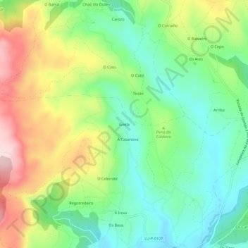
Name: Goela topographic map, elevation, terrain.
Location: Goela, Fanoi, Abadín, Terra Chá, Lugo, Galicia, 27730, Spain (43.37023 -7.50550 43.41023 -7.46550)
Average elevation: 599 m
Minimum elevation: 475 m
Maximum elevation: 800 m
Thank you for supporting this site ❤️
Make a donation
Make a donation
Gear up for your next adventure:
As an Amazon Associate, this site earns from qualifying purchases at no extra cost to you.