
Skopus topographic map
Interactive map
Click on the map to display elevation.
About this map
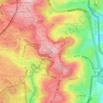
Name: Skopus topographic map, elevation, terrain.
Average elevation: 743 m
Minimum elevation: 609 m
Maximum elevation: 832 m
Other topographic maps
Click on a map to view its topography, its elevation and its terrain.
Temple Mount
Israel > Jerusalem District > Jerusalem
The exact moment when the concept of the Mount as a topographical feature separate from the Temple or the city itself first came into existence is a matter of debate among scholars. According to Eliav, it was during the first century CE, after the destruction of the Second Temple. Shahar and Shatzman reached…
Average elevation: 740 m