
Cerro del León topographic map
Interactive map
Click on the map to display elevation.
About this map
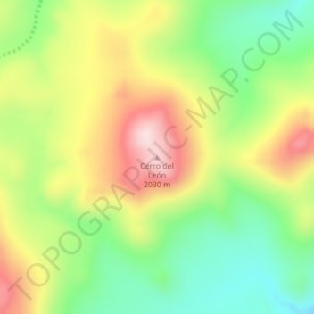
Name: Cerro del León topographic map, elevation, terrain.
Location: Cerro del León, Departamento Picunches, NQN, Argentinien (-38.79457 -70.56738 -38.79447 -70.56728)
Average elevation: 1,834 m
Minimum elevation: 1,682 m
Maximum elevation: 2,022 m
Other topographic maps
Click on a map to view its topography, its elevation and its terrain.
Carrasco
Argentinien > NQN > Plottier
Carrasco, Plottier, Departamento Confluencia, NQN, Argentinien
Average elevation: 287 m
Laguna Calafate
Argentinien > NQN > Villa La Angostura
Laguna Calafate, Pedro Vidal, Mallin, Villa La Angostura, Departamento Los Lagos, NQN, 8407, Argentinien
Average elevation: 804 m
Copahue
Argentinien > NQN > Copahue
Copahue, Departamento Ñorquín, NQN, Argentinien
Average elevation: 2,047 m