
Hastings Country Park topographic map
Interactive map
Click on the map to display elevation.
About this map
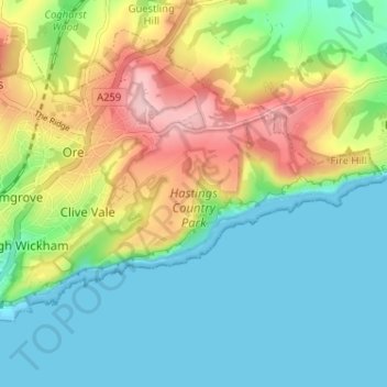
Name: Hastings Country Park topographic map, elevation, terrain.
Average elevation: 58 m
Minimum elevation: 0 m
Maximum elevation: 173 m
East Sussex trails, hiking, mountain biking, running and outdoor activities
Other topographic maps
Click on a map to view its topography, its elevation and its terrain.
Fairlight Glen Naturist Beach
United Kingdom > England > East Sussex > Hastings
Average elevation: 61 m