
Las Faldas topographic map
Interactive map
Click on the map to display elevation.
About this map
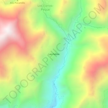
Name: Las Faldas topographic map, elevation, terrain.
Location: Las Faldas, Peque, Occidente, Antioquia, 057010, Colombia (7.02679 -75.92299 7.06679 -75.88299)
Average elevation: 1,730 m
Minimum elevation: 1,087 m
Maximum elevation: 2,503 m